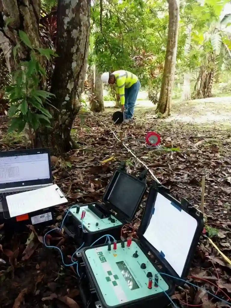
We've run resistivity lines across enough sites in Overland Park to know that the Pennsylvanian limestone and shale sequence doesn't read the textbook. What looks like competent rock on a boring log can hide a dissolved lens, a groundwater channel, or a weathered seam that daylighting alone won't catch. Vertical electrical sounding (VES) and 2D resistivity imaging give us a continuous profile between boreholes—something mechanical exploration alone cannot deliver on a budget that makes sense for commercial or municipal work. When a structural engineer asks whether the bearing stratum is truly continuous under a proposed pad, our first move is often a resistivity transect coupled with targeted SPT drilling to ground-truth the geophysical signature. The combination works especially well here because the resistivity contrast between saturated clay residuum and intact limestone is strong enough to map with confidence, even in winter when surface conditions are less than ideal.
In Overland Park's limestone-shale sequence, resistivity is often the first tool that tells you the rock isn't as solid as the driller's refusal depth suggests.
How we work
Site-specific factors
Overland Park sits on the Cherokee Group and overlying Quaternary deposits that are notorious for unpredictable bedrock surface topography. Miss a buried cut or a solution-widened joint, and you can be looking at differential settlement that no amount of overexcavation will fix cheaply. Resistivity surveys pick up these features because air-filled or water-filled voids produce a sharp resistivity contrast against the host limestone. The bigger risk, in our experience, is relying solely on probe spacing that's too coarse to resolve narrow features. We've had cases where a 20-foot electrode spacing missed a 3-foot-wide weathered seam that a 5-foot spacing caught immediately. That's not a flaw in the method; it's a survey design choice that has to match the expected scale of the karst features in this part of Johnson County. When the geophysical layout is tuned to local geology, the risk of a costly redesign during excavation drops substantially.
Standards used
ASTM D6431-18, ASCE 7-22 (seismic site class input), IBC 2021 Section 1803 (subsurface investigation requirements), USACE EM 1110-1-1802 (geophysical exploration for engineering)
Linked services
2D Electrical Resistivity Imaging
Multi-electrode arrays for continuous subsurface profiles along proposed building footprints, pipeline alignments, or roadway corridors in Johnson County.
Vertical Electrical Sounding (VES)
Point soundings for depth-to-bedrock and groundwater table estimation, ideal for smaller sites or supplemental data between borings.
Karst and Void Detection Surveys
High-resolution dipole-dipole surveys designed to locate dissolution features, cavities, and weathered seams in the Pennsylvanian limestone beneath Overland Park.
Resistivity-Boring Correlation Reports
Integrated deliverables that overlay resistivity sections with SPT and rock core logs, providing a calibrated ground model for foundation design review.
Typical parameters
Common questions
How deep can a resistivity survey reach at a typical Overland Park site?
With the arrays we commonly deploy in Johnson County—600 to 1,200 feet of spread length—we reliably image to 80 or 100 feet below grade. The actual depth of investigation depends on the array geometry and the background resistivity of the soil and rock. In the clay-rich residuum overlying limestone, the depth is somewhat reduced compared to drier sites, so we size the array accordingly during survey design.
What's the cost range for a resistivity survey on a commercial lot in Overland Park?
For a typical commercial lot in Johnson County—assuming a single transect of 400 to 600 linear feet with 2D imaging and a summary report—the work generally falls between US$690 and US$1.190. Larger sites requiring multiple parallel lines or complex topography may exceed that range, and we provide a firm quote after reviewing the site geometry and project objectives.
Can resistivity tell the difference between a water-filled void and a clay-filled seam?
Usually yes, because the resistivity contrast is different. A water-filled void in limestone reads as a very low-resistivity anomaly, while a dry clay-filled seam often shows intermediate values. The interpretation isn't automatic, though—we calibrate against any available boring data and consider the geologic context of the Pennsylvanian section specific to Overland Park before drawing conclusions.
Do you need to drill borings in addition to running a resistivity survey?
We strongly recommend at least one or two calibration borings. Resistivity gives you continuous coverage between points, but the geologic interpretation of the geophysical signal requires ground truth. A boring that identifies the top of rock, groundwater level, and soil type at a known location lets us anchor the resistivity section with confidence, which is standard practice under ASTM D6431.